 |  |  |  |  |  |  |  |  |  |  | |
www.kitzastro.net

Island 2021
Golden Circle
|
|
 Besides Reykjavik, one of the most famous parts of Iceland is the so-called Golden Circle. Here you will find a lot of natural monuments and sights that can be easily reached in a day trip from Reykjavik. This is why this region is one of the first destinations of all tourists who are only briefly in Iceland - mostly Reykjavik - and cannot cover greater distances. Highlights are Thingvellir, Strokkur Geyser and Gullfoss, which are not far from each other... |

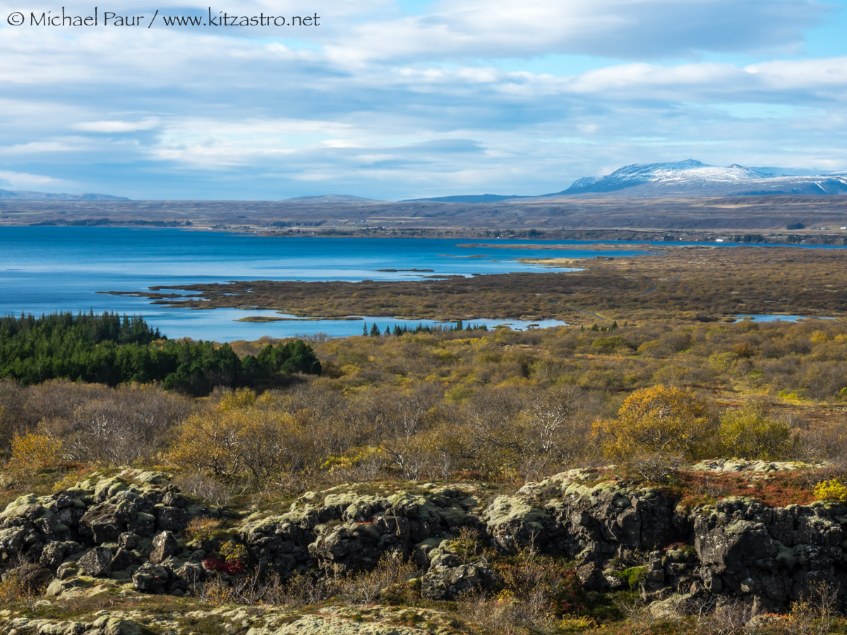 |
| Nationalpark
Thingvellir - ein für die Geschichte Islands bedeutender Ort. Hier
wurden bereits um 930 regelmäßige Versammlungen, welche gesetzgeberische und auch gerichtliche Funktionen hatten, abgehalten - somit eines der ältesten Parlamente der Welt... An diesem historischen Ort wurde auch am 17. Juni 1944 die Republik Island ausgerufen Thingvellir National Park - a place of great significance in the history of Iceland. Regular meetings were held here as early as 930 which had legislative and judicial functions - thus one of the oldest parliaments in the world...The Republic of Iceland was proclaimed at this historic location on June 17, 1944 Sony RX10-III |
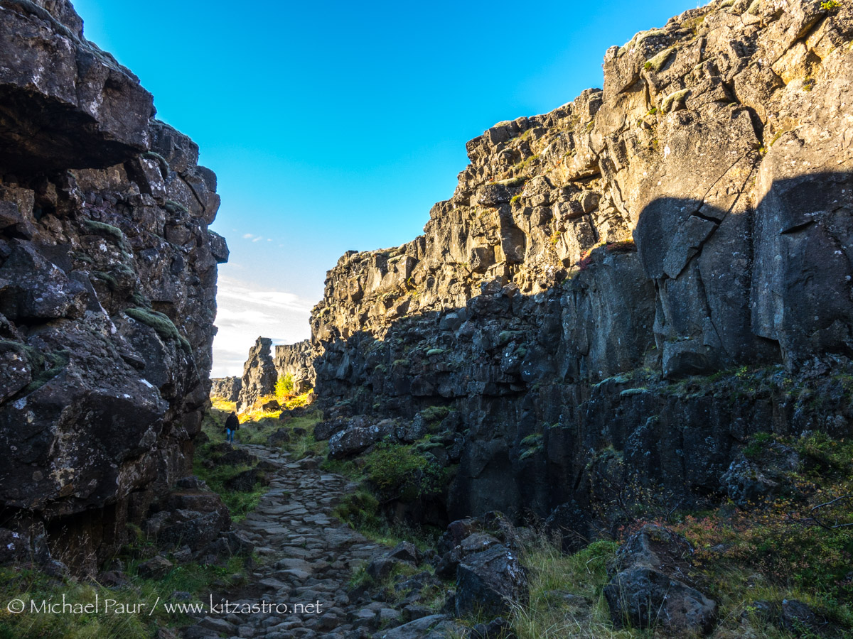 |
| Im Nationalpark an der Almannagjá (Allmännerschlucht)wird
auch das Auseinanderdriften der amerikanischen und eurasischen
tektonischen Platten durch imposante Felsspalten und Risse sichtbar. In
den letzten 10.000 Jahren ist das Land beiderseits der Schlucht
Almannagjá um 70 Meter auseinandergedriftet und der Talboden hat sich
um ca. 40 Meter gesenkt. In the national park at the Almannagjá (Allmännerschlucht) the drifting apart of the American and Eurasian tectonic plates becomes visible through imposing crevices and cracks. In the last 10,000 years the land on both sides of the Almannagjá gorge has drifted apart by 70 meters and the valley floor has sunk by around 40 meters. Sony RX10-III |
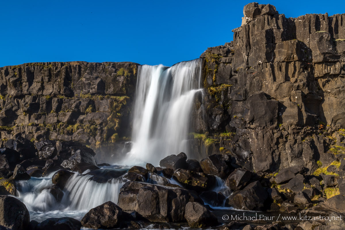 |
| ...dadurch hat sich auch genau hier am Fluss Öxara ein schöner Wasserfall, der Öxararfoss, gebildet. ...as a result, a beautiful waterfall, the Öxararfoss, has formed right here on the Öxara river. Canon EOS 6D MK2 |
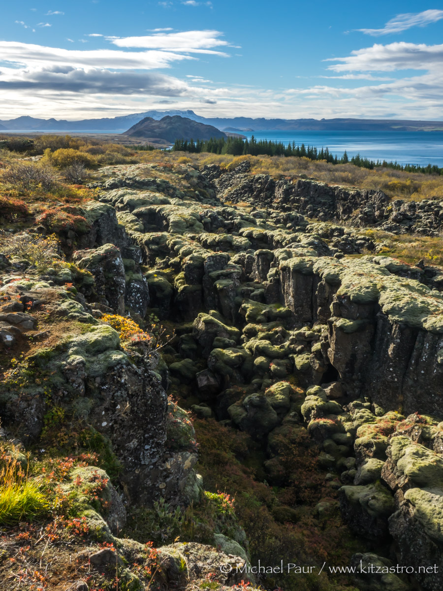 |
| Überall Graben und Brüche... Ditches and breaks everywhere... Sony RX10-III |
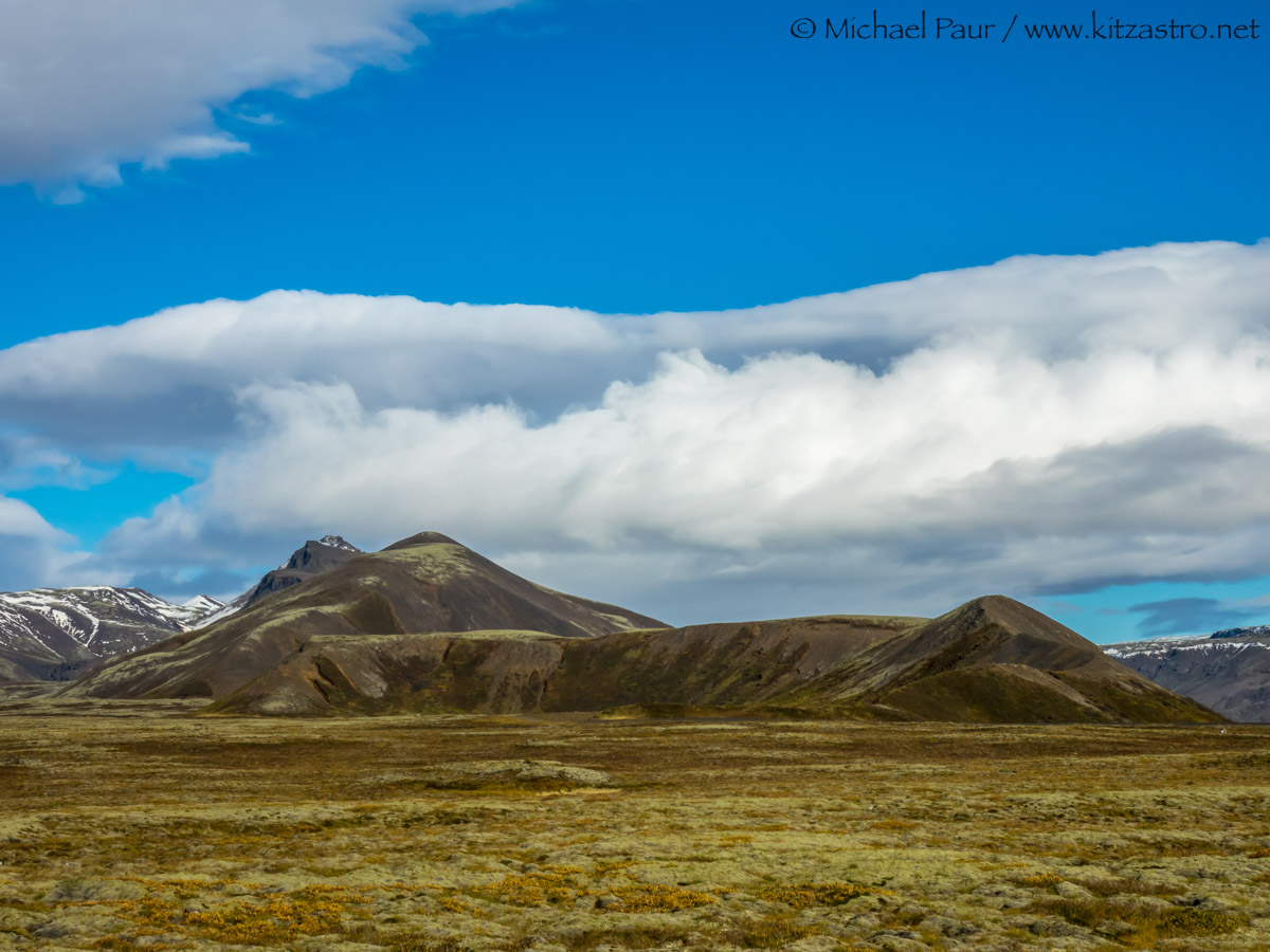 |
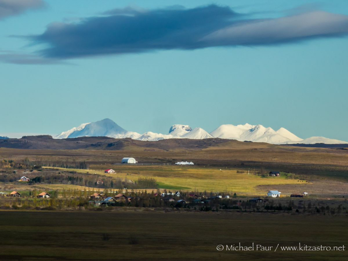
| Berge nahe Laugarvatn - auf dem Weg Richtung Geysir... Mountains near Laugarvatn - on the way to Geysir... Sony RX10-III |
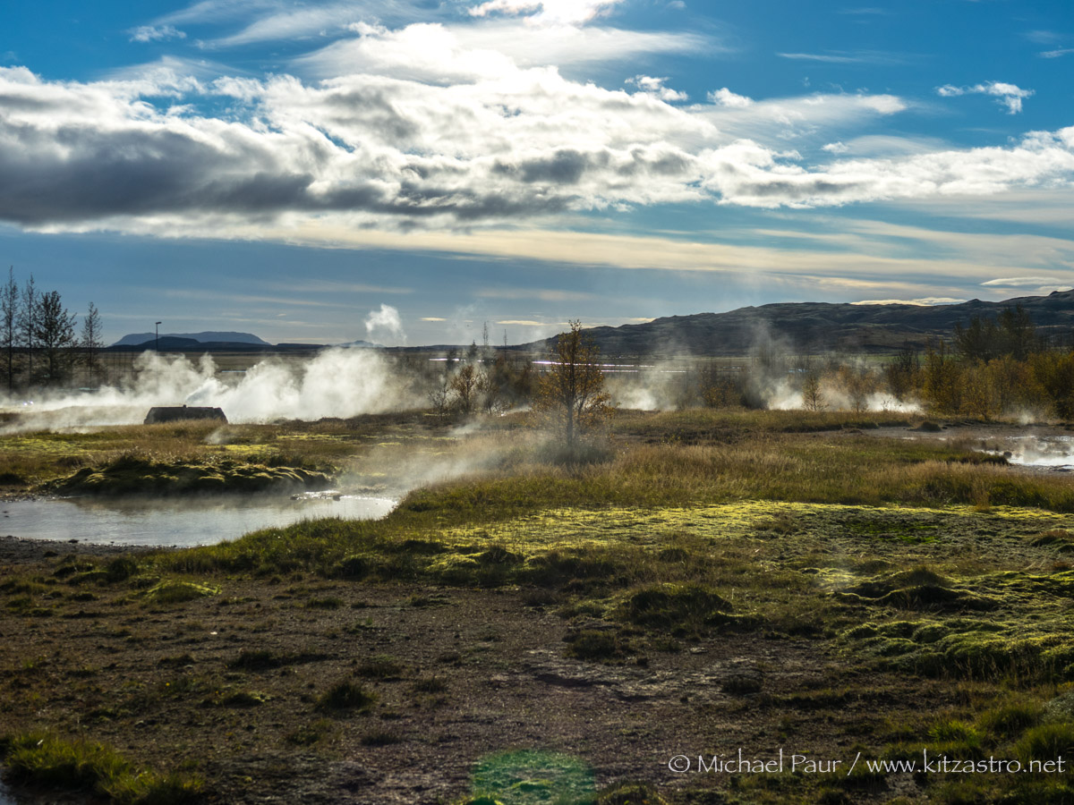 |
| Haukadalur - ein Hochtemperaturgebiet rund um das aktive Vulkansystem des großen Geysirs am Fuße des Berges Laugarfjall... Haukadalur - a high temperature area around the active volcanic system of the great geyser at the foot of the mountain Laugarfjall... Sony RX10-III |
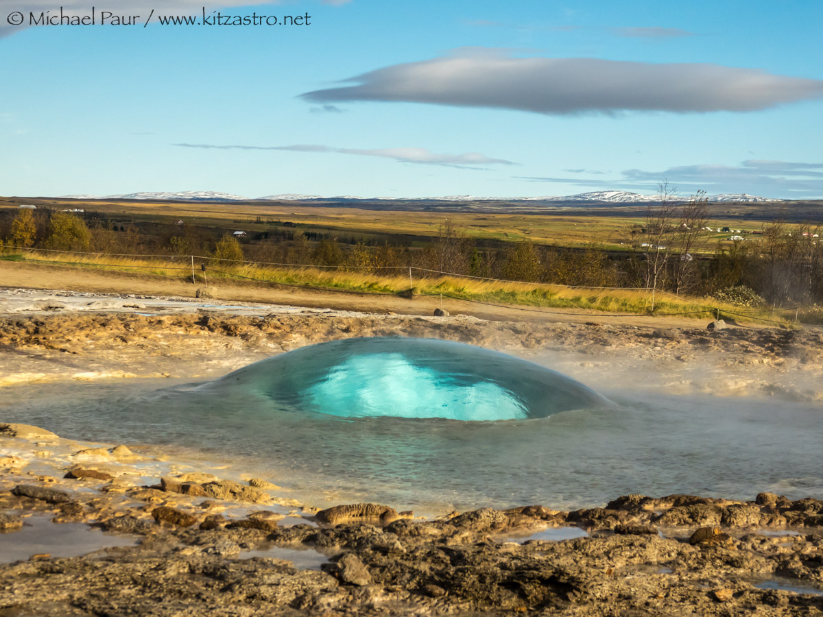 |
| Der Strokkur im Moment seines Ausbruchs... The Strokkur at the moment of it´s eruption... Sony RX10-III |
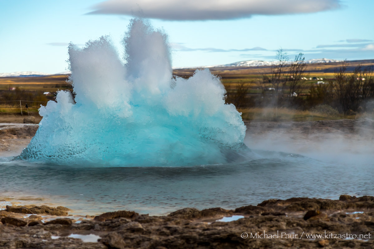 |
| ...die Blase platzt und die Mischung aus Wasser und Wasserdampf schießt in die Höhe... ...the bubble bursts and the mixture of water and water vapor soars... Canon EOS 6D MK2 |
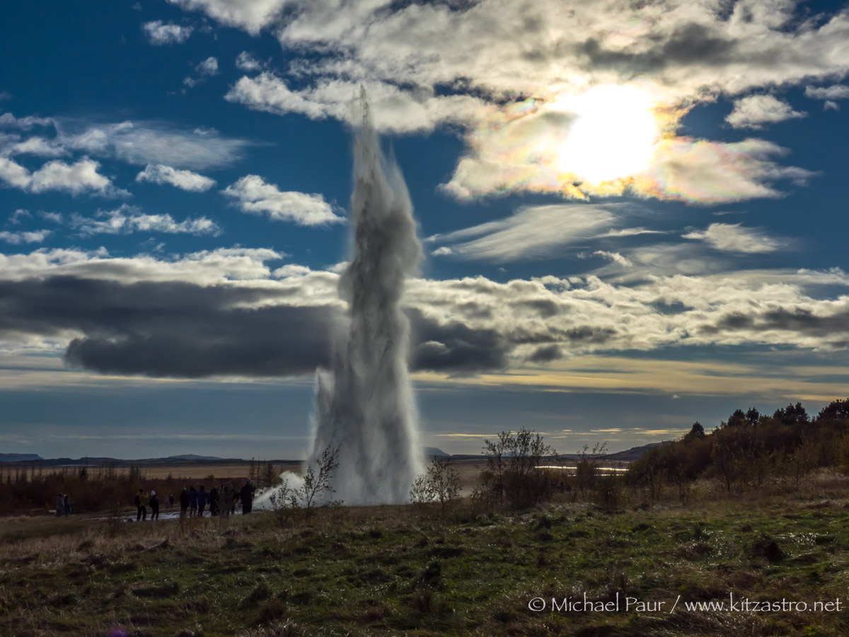 |
| Alle ca. 10 Minuten bricht er aus (manchmal auch 3x kurz hintereinander) und erreicht eine Höhe von ca. 25-30 Meter... Every 10 minutes it breaks out (sometimes 3x in quick succession) and reaches a height of about 25-30 meters... Sony RX10-III |
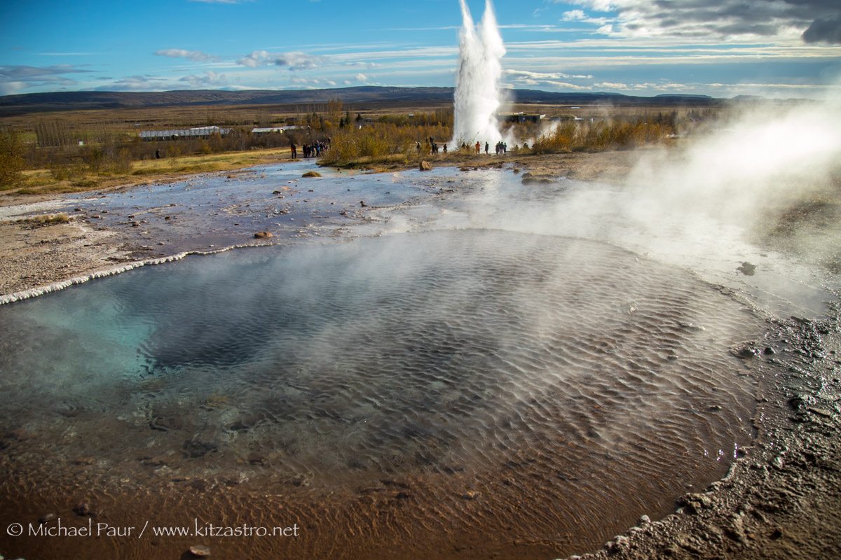 |
| Der Fata Gesyir mit dem Strokkur im Hintergrund... The Fata Gesyir with the Strokkur in the background... Canon EOS 6D MK2 |
 |
|
Der Gebirgszug des Kerlingarfjöll weit hinten im Hochland
Links: Ögmundur (1357m), Mitte (mit Plateau): Höttur(1312m), Rechts: Snaekollur (1488m)... The Kerlingarfjöll mountain range far back in the highlands Left: Ögmundur (1357m), middle (with plateau): Höttur (1312m), right: Snaekollur (1488m)... Sony RX10-III
|
 |
|
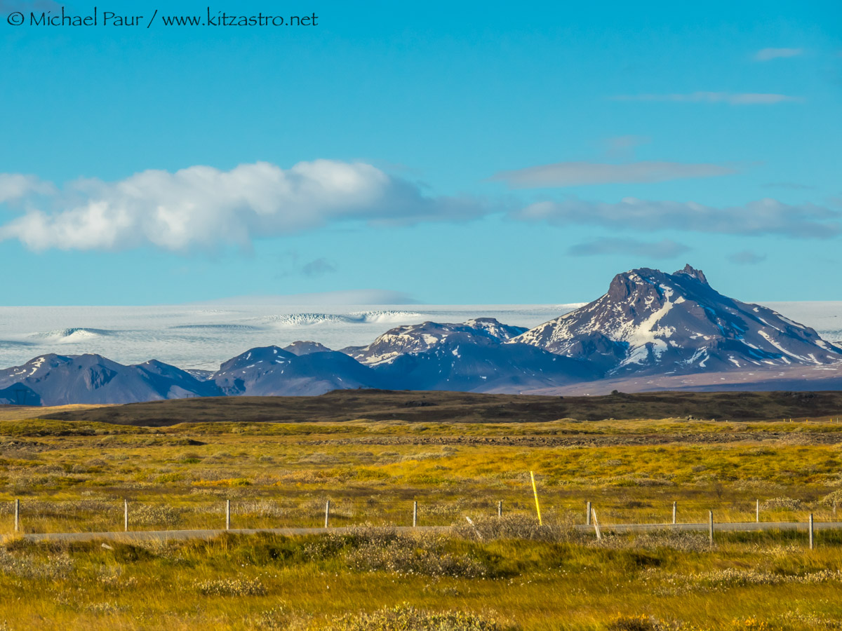
...Stora-Jarlhetta (rechts, 943m) vor dem Massiv des Langjökull Gletschers...
...Stora-Jarlhetta (right, 943m) in front of the Langjökull Glacier massif... Sony RX10-III |
|
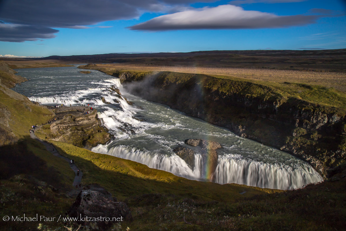
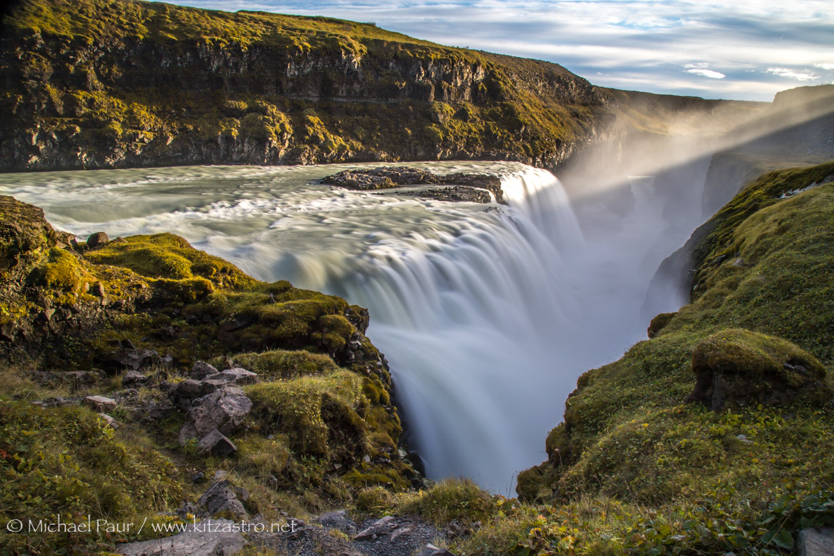
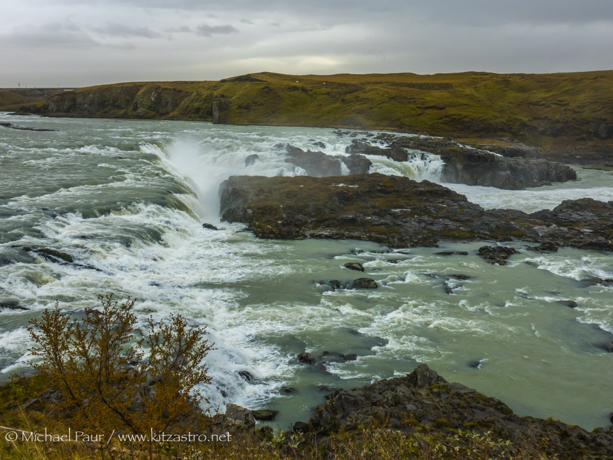
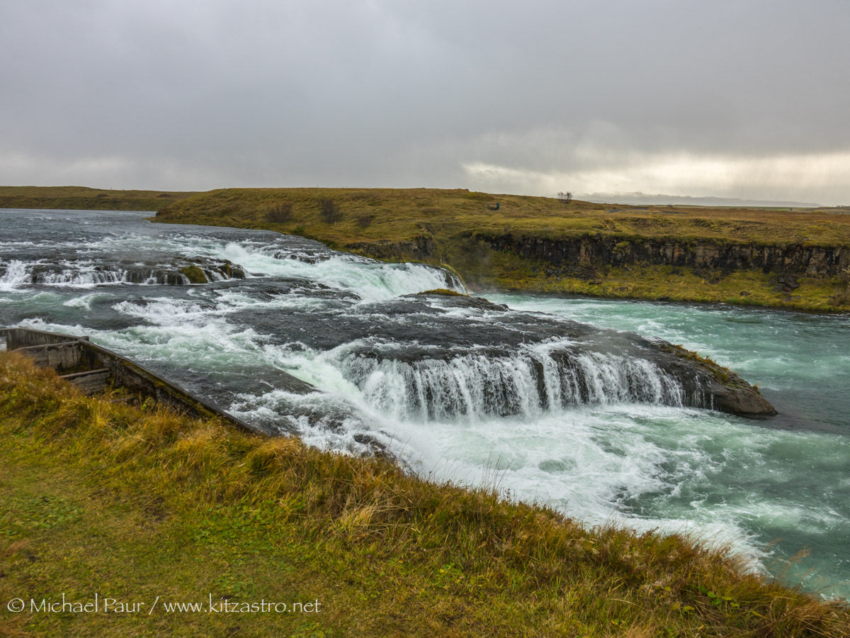
| ...der Gullfoss - das Wasser des Flusses Hvita stürzt hier in 2 Stufen 11 und 21 m in die Tiefe. Die beiden Kaskaden stehe ndabei fast rechtwinklig zuenander... ...Gullfoss waterfall - the water of the river Hvita falls here in 2 stages 11 and 21 m deep. The two cascades are almost at right angles to each other... Canon EOS 6D MK2 |
|
|
...an der zweiten Stufe stürzt das Wasser mit einem atemberaubenden Getöse in eine tiefe Schlucht...
...at the second step the water plunges into a deep gorge with a breathtaking roar... Canon EOS 6D MK2 |
|
|
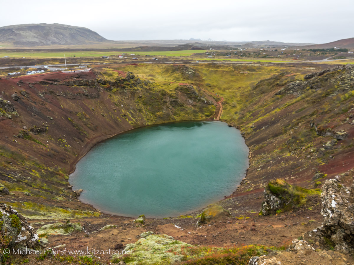
...ca. 15km nördlich von Selfoss ist der schöne Kratersee Kerid zu finden.
Ein rund 6500 Jahre alter, ungefähr 270x170m großer und 55mm tiefer Krater... ...the beautiful Kerid crater lake can be found approximately 15km north of Selfoss. A roughly 6500 year old, 270x170m large and 55mm deep crater .... Sony RX10-III |
|
|
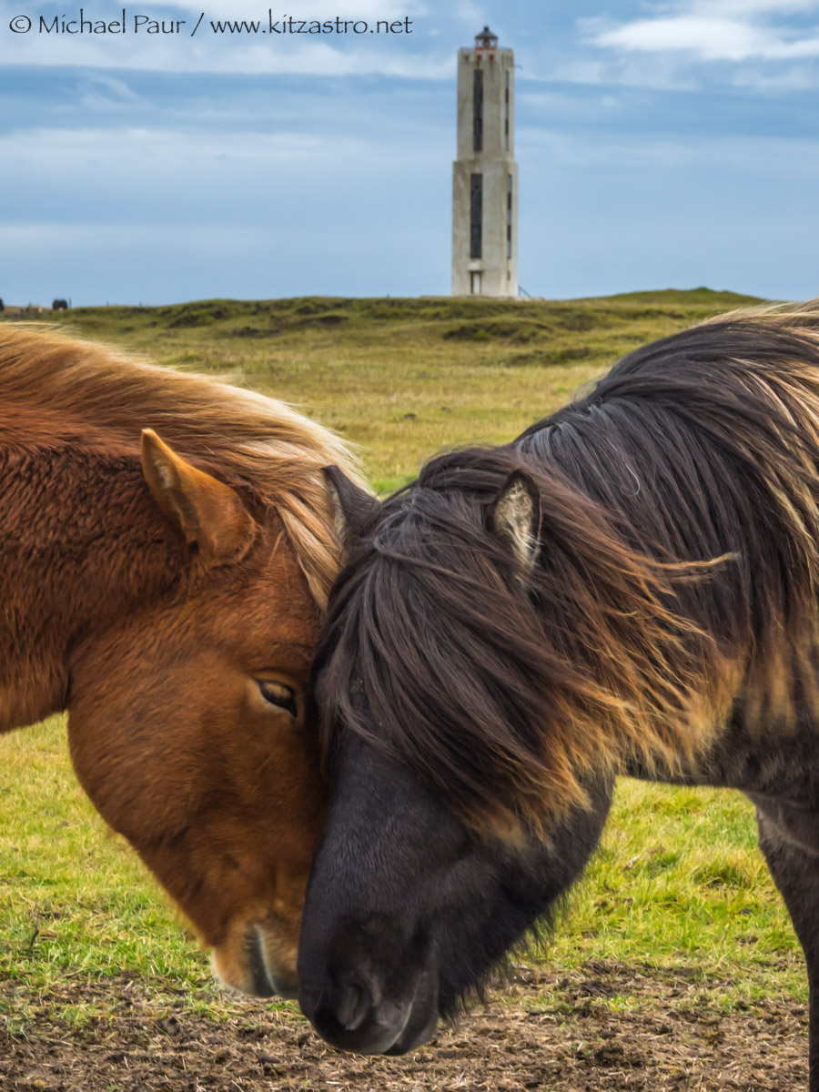
...an der Küste südlich von Selfoss steht der Leuchtturm Knarrarosviti.
Die Island-Ponys stehlen ihm hier auf diesem Bild aber die Show :-) ...the Knarrarosviti lighthouse is on the coast south of Selfoss. The Icelandic ponies steal the show from him in this picture :-) Sony RX10-III |
|
|
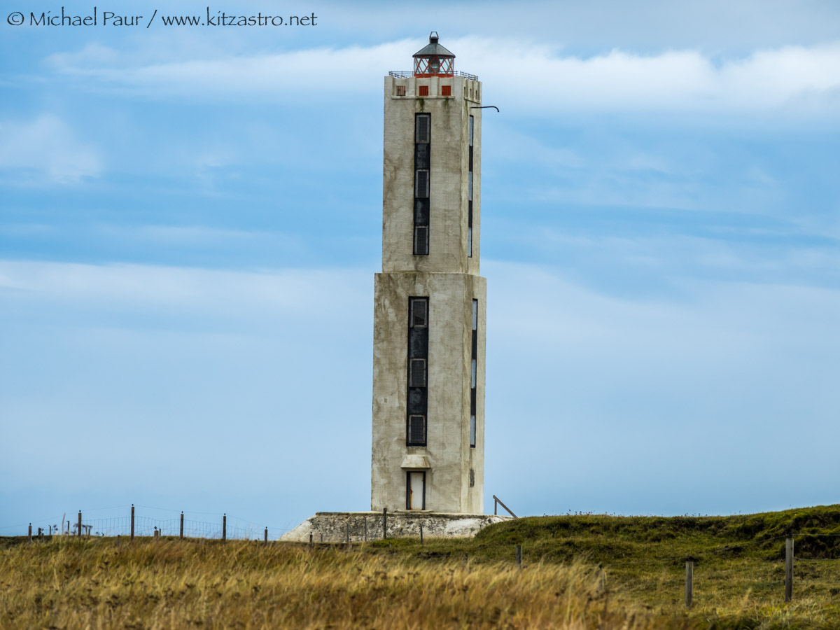
...der 26m hohe Leuchtturm ist im Jugendstil errichtet. Es war der erste Leuchtturm Islands, der aus Stahlbeton gebaut ist.
...the 26m high lighthouse is built in Art Nouveau style. It was the first lighthouse in Iceland to be built from reinforced concrete. Sony RX10-III |
|
|
...auf dem Weg weiter nach Osten passieren wir den eher unbekannten, aber sehr breiten und damit wasserreichen Urridafoss.
...on the way further east we pass the rather unknown, but very wide and therefore water-rich Urridafoss.. Sony RX10-III |
|
| Der Aegissidufoss ist ein kleinerer Wasserfall bei Hella - die Ytri-Ranga stürzt hier 3 Meter in die Tiefe. The Aegissidufoss is a smaller waterfall near Hella - the Ytri-Ranga plunges 3 meters down here.... Sony RX10-III |
...es folgen die großen, beeindruckenden Wasserfälle im äußersten Süden
 |
zurück zur Island-Übersicht